Snow Magazine snow reports in association with

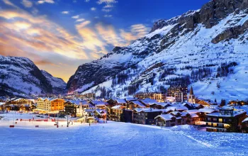
After the storms… comes the fun. Pretty much everywhere in the Alps is celebrating the best start to a ski season for years, with more than two metres at altitude and a respectable base even at lower levels, thanks to temperatures remaining cold.
Although the northern and north-western French and Swiss Alps and western Austria are generally lording it over the rest, decent dumps have now reached the southern French Alps, Italy and even the lower Austrian resorts.
There’s not a lot of snow in the forecast for the Christmas weekend, so with mostly clear skies and a nip still in the air, our advice now is to get out and enjoy near-perfect conditions.
French resorts in the Alpes Maritime, such as Isola 2000 (110/190cm) and most of the northern Italian resorts can, however, look forward to another dump on Christmas night and into Boxing Day.
FRANCE
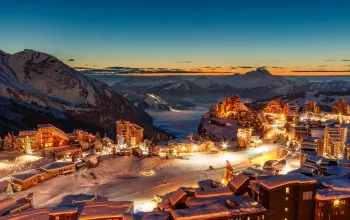
Les Arcs (115/220cm) and La Plagne (105/260cm) had an awesome opening weekend and the links between the two resorts will be fully running from today. Snow depths are amazing here for this early in the season!
As the last remaining resorts in the Grand Massif join the party this weekend, Flaine (110/230cm) is looking particularly lush.
The Three Valleys are among many French resorts where huge smiles are the order of the day and where it feels like the scratchy Christmasses of recent years are well and truly behind us. Val Thorens (140/240cm) is skiing wonderfully as is La Tania (100/140cm) with lovely powdery runs through the trees.
Hard to be sure this far out, but middle of next week might see a return to snowy conditions.
AUSTRIA
The best snow to be found in Austria is in the far west (e.g. St Anton, Lech). The least favourable areas (but where there is still plenty of good on-piste skiing) are now the lower resorts of the Austrian Salzburgland and Tirol, such as Kitzbühel (40/70cm), where rain at low levels and mist will take the gloss off the rest of this week.
The Skicircus resorts such as Saalbach Hinterglemm (80/100cm), Leogang (60/120cm), Fieberbrunn (80/100cm) are getting some moderate to heavy snow (up to 30cm) the rest of this week, before the skies clear in time for Christmas.
It’s a similar pattern in the already very blessed Arlberg, where Lech (120/165cm) and St Anton (70/180cm) are forecast around 20cm.
And the Ski Welt Wilder Kaiser area around Ellmau (35/110cm) will have to contend with snow turning to rain at lower levels followed by a bit of mist before the sun eventually comes out!
ITALY
Like elsewhere, the next few days will be quiet but the snow returns to north western resorts, especially, on Christmas Night into Boxing Day with around 30cm forecast for Madonna di Campiglio (50/100cm) and up to 20cm for Madesimo (110/180cm). Slightly lower totals for the eastern Dolomites, where Alta Badia (60/90cm) and Arabba (40/100cm) can look forward to top-ups of around 15cm. Arabba has been busy preparing its snow park for this weekend’s opening.
SWITZERLAND
Here too, the picture is mostly one of a quiet rest of the week with some snow – but a risk of rain at lower levels – before a sunny, lovely Christmas with some fabulous bluebird days, before the snow creeps back to much of the country around Boxing Day!
Best snow is still to be found in Engelberg (60/360cm) and around Gstaad (60/250cm), but the Jungfrau resorts like Grindelwald (50/160cm), Verbier (120/140cm) and Saas Fee (50/180cm).
PYRENEES
Andorra is skiing well, with Grandvalira (40/100cm) topping the table after a mighty half-metre in the past week. Here too, a sunny week is in store before the flicker in the forecast of fresh snow from Boxing Day. And that’s the same story in the French Pyrenees where St Lary (80/180cm) will swap today’s snow flurries for sunshine, again with the hint of more snow to come around the middle of next week. Over on the Spanish side Formigal (40/100cm) is anticipating a heavy dump of 20cm+ from Boxing Day.
SCANDINAVIA
Moderate snowfalls of around 15-20cm this week are expected in Are, Sweden (50/60cm) is hoping the sun will peep out on Christmas Day at least. In Norway, Voss (130/150cm) continues to pile up the snow, with another half metre due over the next week – but no sun. More chance of clearing skies around Lillehammer (40/70cm) and Hemsedal (60/70cm) where most of the new snow is expected from Christmas Day.
CANADA
There’s plenty of sunshine around between now and Christmas to make the most of the wonderful skiing at Whistler (150cm) and elsewhere on the western side, such as Lake Louise (89/132cm) and Sun Peaks (79/107cm). Revelstoke (137cm) is currently enjoying some lovely soft powder skiing. Some fresh snow is due, mostly after Christmas, but the biggest falls are forecast out east, where Mont Sainte-Anne (20/64cm) could do with the top-up coming Friday into Saturday.
US
The country’s poor start to its season continues, with modest snow only and a lot of blue skies and sunshine over the next week, which, combined with plunging cold temperatures will keep things ticking over till the next big dump. When that will be is less certain.
The Colorado and Utah resorts are still awaiting a really big snowfall, while Mammoth in California (50/150cm) has had a few snow showers but the outlook is sunny. In Wyoming, Jackson Hole (76/130cm) had an overnight top-up and is reporting good skiing at upper levels. North to Aleyska (25/173cm) in Alaska, where colder weather has finally kicked in, and around 20cm of fresh snow is expected this weekend.
SCOTLAND
All the Scottish resorts are open, but with depths of no more than 5/30cm are very vulnerable to the current milder temperatures over the UK. No real fresh snowfall since 14 December means the snow is hard-packed and not many runs are open. However, the Nevis Range is expecting around 20cm of new snow over Christmas.
Unmissable January getaways in the Alps with Alpine Elements from as little as £365 including flights and transfers!


